Philadelphia train map
You can find on this page the Philadelphia trains map to print and to download in PDF. The Philadelphia trains map presents the rail network and railway stations of the trains of Philadelphia in Pennsylvania - USA.
Philadelphia rail map
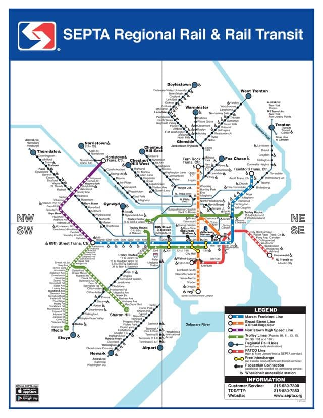
The Philadelphia rails map shows all the railway stations and lines of Philadelphia trains. This railway map of Philadelphia will allow you to easily plan your route with the trains of Philadelphia in Pennsylvania - USA. The Philadelphia rails map is downloadable in PDF, printable and free.
The SEPTA Regional Rail system (reporting marks SEPA, SPAX) consists of commuter rail service on thirteen branches to over 150 active stations in Philadelphia, Pennsylvania, United States and its suburbs. Service on most lines runs from 5:30 AM to midnight. The core of the Regional Rail system is the Center City Commuter Connection composed of three Center City stations in the “tunnel” corridor: the above-ground upper level of 30th Street Station; and the underground Suburban Station; and Market East Station. All trains stop at these Center City stations, and most also stop at Temple University station on the campus of Temple University in North Philadelphia. Operations are handled by the SEPTA Railroad Division as its mentioned in Philadelphia rail map.