Philadelphia topographic map
You can find on this page the Philadelphia topographic map to print and to download in PDF. The Philadelphia elevation map present the topography, river and relief of Philadelphia in Pennsylvania - USA.
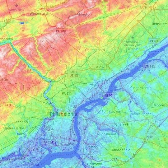
Philadelphia elevation map
The Philadelphia topographic map shows elevation, hills and landforms in Philadelphia. This elevation map of Philadelphia will allow you to know topography, river and relief of Philadelphia in Pennsylvania - USA. The Philadelphia topographic map is downloadable in PDF, printable and free.
The elevations of features and distances between points in the United States were determined from surveys and topographic maps of the U.S. Geological Survey or obtained from other sources. In most cases, the elevations were determined from surveys and from 1:24,000- and 1:25,000-scale, 7.5-minute topographic quadrangle maps. In Alaska, information was taken from 1:63,360-scale, 15-minute topographic quadrangle maps. In a few cases, data were obtained from older, 1:62,500-scale, 15-minute maps; these maps have been replaced with larger scale 7.5-minute coverage. Philadelphia elevation ranges from 5 feet to 431 feet above sea level as its mentioned in Philadelphia elevation map.