Philadelphia postcodes map
You can find on this page the Philadelphia zipcodes map to print and to download in PDF. The Philadelphia zip code map presents postal codes, address lookup and code list of Philadelphia in Pennsylvania - USA.
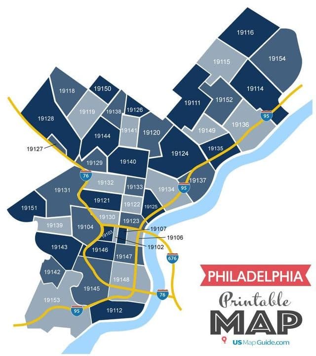
Philadelphia postcodes map
The Philadelphia postcodes map shows all the zip codes of Philadelphia. This zip code map of Philadelphia will allow you to easily find postal codes and address lookup of Philadelphia in Pennsylvania - USA. The Philadelphia postcode map is downloadable in PDF, printable and free.
The USPS does not officially correlate neighborhood names to Philadelphia postcodes (all are called simply “Philadelphia” or “Phila”). However, the 19118 postcode as you can see in Philadelphia postcodes map is almost entirely coterminous with the cultural-consensus boundaries of Chestnut Hill. City of Philadelphia, PA covers 6 Area Codes and 87 postcodes.