

You can find on this page the Philadelphia bike map to print and to download in PDF. The Philadelphia bicycle map presents the bike routes and lanes of Philadelphia in Pennsylvania - USA.

The Philadelphia bike lane map shows all the bike routes of Philadelphia. This bicycles lanes map of Philadelphia will allow you to easily plan your routes with a bike in Philadelphia in Pennsylvania - USA. The Philadelphia bike lanes map is downloadable in PDF, printable and free.
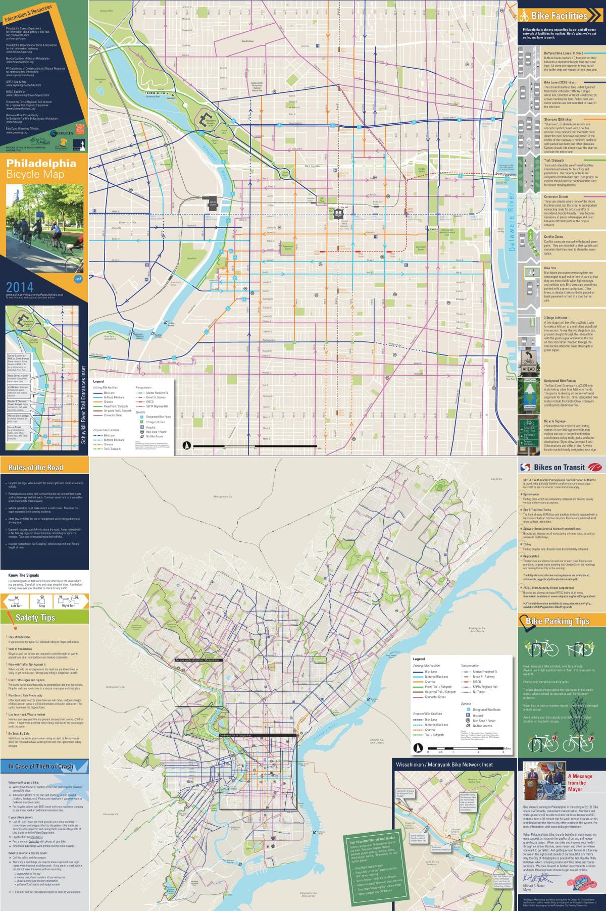
Philadelphia has become one of the most bike-friendly big cities in the country with dedicated bike lanes on city streets, hundreds of miles of trails and a growing number of bicycle commuters. 440+ miles of dedicated bike lanes, 750 miles of bike trails in the works with 300+ miles completed so far, 1,300+ bikes that can be rented at more than 140 stations across the city as its mentioned in Philadelphia bike lane map. Philadelphia is home to miles of excellent running and biking trails, many of which pass by historic attractions, weave around rivers and wind through parks. The Centennial 5K Route is a paved path that weaves its way through grassy parkland in Fairmount Park, perfect for joggers looking for a 5K loop or families seeking a well-marked path to cruise along on a shorter bike ride.
One of Philly most popular running and biking lanes, the Kelly Drive and Martin Luther King Jr. Drive Loop is a nine-mile lap that hugs both sides of the Schuylkill River as you can see in Philadelphia bike lane map. The paved path — part of the larger Schuylkill River Trail — begins near the Philadelphia Museum of Art and winds its way along Boathouse Row to the Falls Bridge in East Falls. Cross over the bridge to the opposite side of the river and head back toward the city to finish the second half of the loop on Martin Luther King Jr. Drive. The Schuylkill Banks is open year-round for walking, jogging, cycling, picnics and dog-walking. Start at the Schuylkill Banks Boardwalk, which extends the trail out over the river, and continue along the path to the Philadelphia Museum of Art for a nice 1.6-mile jog or ride — as well as fantastic views of the Philadelphia skyline.
While not technically a trail, Spruce Street extends from the Schuylkill River to the Delaware River and is certainly one of Philly most beautiful roads. Start at 25th and Spruce streets and pass through scenic neighborhoods like Society Hill, Washington Square West and Rittenhouse Square on the way to Spruce Street Harbor Park — the perfect location to cool down when it is open during the warmer months as its shown in Philadelphia bike lane map. The beautiful, iconic Benjamin Franklin Bridge spans just one and a half miles across the Delaware River, connecting Philadelphia to New Jersey. Start at Fifth and Race streets and take the pedestrian walkway across the bridge and back for a three-mile workout, complete with an impressive look at the skyline.